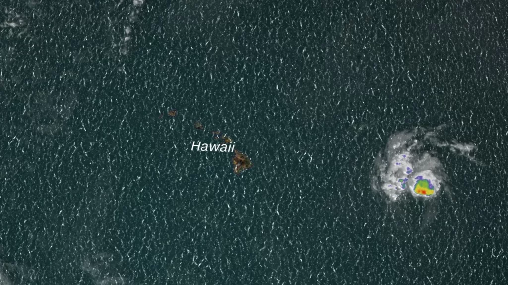
The Hawaiian island of Hawaii’s Big Island is currently under a tropical storm warning due to the approach of Tropical Storm Calvin. The storm’s projected path indicates that it will pass over or near the southern part of the island, posing threats of dangerous coastal surf, heavy rainfall, and gusty winds, as reported by the National Hurricane Center.
The arrival of Tropical Storm Calvin poses a significant risk to the Hawaiian islands

Although Calvin is expected to maintain its status as a weak tropical storm, it is moving rapidly westward and is currently approximately 570 miles east of Hilo, with sustained winds reaching 45 mph as of late Monday night.
The most significant concern lies in the heavy rainfall, leading to the issuance of flood watches for several islands, including Maui, Molokai, Lanai, Kahoolawe, and the Big Island. The watch extends from Tuesday evening through Wednesday afternoon. The National Weather Service in Honolulu has warned that excessive rainfall could result in flooding and landslides, especially in areas with steep terrain, particularly along east and southeast-facing slopes.
Furthermore, the storm is expected to generate swells and rapid surf along the east-facing shorelines on Tuesday and into Wednesday. The National Weather Service cautioned that these elevated surf conditions could pose life-threatening dangers in some areas.
The projected rainfall amounts indicate that the Big Island’s windward areas might receive between 4 to 8 inches of rainfall through Thursday, while other regions across the state can expect 1 to 4 inches, as stated by the National Hurricane Center.


